![]()
17 June 2026 | JW Marriott Grosvenor House Hotel
![]()
17 June 2026 | JW Marriott Grosvenor House Hotel
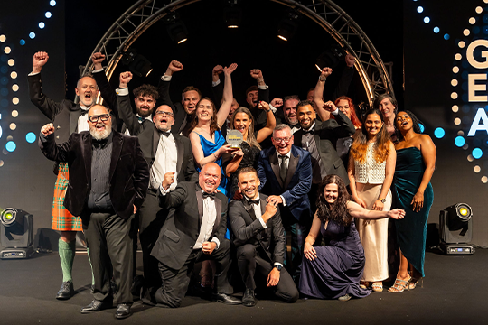
The Ground Engineering Awards bring together industry leaders to celebrate outstanding achievements across projects, people, and businesses from January 2025 to January 2026.
This prestigious event highlights excellence in ground engineering, including the return of the acclaimed GE Workforce Awards categories. It’s the perfect opportunity to showcase your business, stand out from your competitors, and recognise the hard work of your teams.
With categories spanning innovative projects, technical excellence, and forward-thinking companies, all judged by an expert industry panel, the GE Awards are open to any business in the ground engineering sector.
The shortlist has been revealed. The winners will be revealed on 17 June 2026 at the JW Marriot Grosvenor House Hotel in London.
We're proud to announce this year’s finalists for the GE Awards have been selected from an outstanding field of entries.
Take a look at the established award categories promoting geotechnical industry excellence.
Take a look at the workforce categories celebrating great places, initiatives and people driving the sector forwards.
Tailored sponsorship packages are available to suit your marketing aims and budgets.

 The Ground Engineering Awards remain one of the most important events in the geotechnical calendar. They shine a spotlight on the technical excellence, ingenuity, and collaboration that underpin our profession, and celebrate the people and teams who are continuously pushing our industry forward. As the leading national awards for geotechnics, they play a vital role in championing best practice and inspiring the next generation. The BGA is honoured to support this event and to stand alongside our colleagues from across the wider ground engineering community in recognising and promoting excellence in our field.
Yuli Doulala-Rigby, Chair, British Geotechnical Association
Malcolm O’Sullivan, Chair, Federation of Piling Specialists
Hassan Alhasan, Principal Engineer – Geotechnical Lead, Costain
 The Ground Engineering Awards set the industry benchmark for innovation and impact across the profession. The Awards are more than a celebration of technical excellence, highlighting the projects, initiatives, people and teams that deliver real value to clients and communities. By uniting the brightest minds in the sector, the Awards create a forum for sharing and showcasing knowledge, creativity and passion, making the ceremony one of the most anticipated events in the ground engineering calendar.
James Codd, Technical Director, Mott MacDonald
 The GE Awards are a brilliant chance to shine a light on the creativity and technical expertise that make our industry so exciting. They’re not just about celebrating wins—they’re about inspiring new ideas and showing what’s possible in ground engineering
I’m thrilled to be part of the judging panel. It’s a great way for our community to come together, share achievements, and recognise the hard work behind them. If you’re thinking about entering, it’s a fantastic opportunity to showcase what your team has accomplished and get the recognition you deserve.
The GE Awards are a brilliant chance to shine a light on the creativity and technical expertise that make our industry so exciting. They’re not just about celebrating wins—they’re about inspiring new ideas and showing what’s possible in ground engineering
I’m thrilled to be part of the judging panel. It’s a great way for our community to come together, share achievements, and recognise the hard work behind them. If you’re thinking about entering, it’s a fantastic opportunity to showcase what your team has accomplished and get the recognition you deserve.
Catherine McGrath, Category Manager, National Highways
 “We had so many fantastic entries. The quality was high, from people doing all different roles in the industry and from all different backgrounds, which I think was positive to see. Hopefully, that means something positive for the future of the ground engineering industry."
Alice Shrubshall, Associate Director, Buro Happold
 Ground engineering does an excellent job. Everybody thinks of this as the Oscars, and I always tell everyone that unless you come to this event, you don't realise that there are so many geotechnical engineers. It's fantastic for our profession, and it's just a great night out.
Barnali Ghosh, Technical Director, Mott MacDonald

Ebenezer Adenmosun, Director, Geofirma
Jessica T Smith, Senior Engineering Geologist, SSE Renewables
 It’s both a pleasure and a privilege to be asked to judge at the Ground Engineering Awards. I never fail to find inspiration in the innovative solutions and outstanding people and organisations demonstrated in all the entries.
Dave Woods, Technical Manager, Huesker
 I am excited to be judging the GE Awards to shine a spotlight on collaborative and innovative working that helps to drive both safety and quality in getting the job done right first time. The awards really bring the industry together to celebrate our successes.
Ursula Lawrence, Technical Director of Engineering Geology, WSP
 I'm beyond excited to have been asked to judge at this year's Ground Engineering awards.
Feel truly honoured and privileged for what will be my first year judging these prestigious awards.
Look forward to review entries in early 2026 and encourage the industry to showcase itself proudly. Every day we are solving challenges and overcoming uncertainty with exceptional people & solutions, and these awards allow these to shared.
I'm beyond excited to have been asked to judge at this year's Ground Engineering awards.
Feel truly honoured and privileged for what will be my first year judging these prestigious awards.
Look forward to review entries in early 2026 and encourage the industry to showcase itself proudly. Every day we are solving challenges and overcoming uncertainty with exceptional people & solutions, and these awards allow these to shared.
David Major, Preconstruction Leader, Expanded Piling
 The entrants need to demonstrate a high level of achievement and their innovative work which means that the awards become a showcase for our industry.
Kelvin Higgins, Senior Partner, GCG